|
Listen to this article
 |
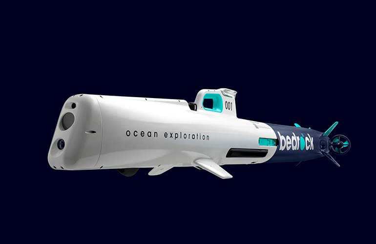
Bedrock Mosiac leverages autonomous underwater vehicles to map the seafloor. | Image credit: Bedrock
Bedrock launches a new ocean survey service, powered by a 100% electric autonomous underwater vehicle (AUV). Bedrock is not selling the AUV, but rather, using the underwater robots to gather and compile undersea imaging data. This information is then presented in Mosaic, a universal survey cloud-based, data platform for managing, accessing, and sharing any marine survey data. According to the National Oceanic and Atmospheric Administration (NOAA), as of February 2021, 80% of the ocean floor remains to be explored, and this is the opportunity for a solution like Mosaic.
In addition to the vast opportunity to autonomously map the seafloor, it can also take up to 12 months per survey to provide customers with usable commercial seafloor data. Bedrock plans to accelerate that situation, claiming it can do so 10 times faster than the current solution.
“The ocean is a key environment we need to deeply understand to save the planet from climate change and provide sustainable, renewable energy,” said Anthony DiMare, co-founder and CEO of Bedrock. “But right now, we simply don’t have the ability to act quickly because we lack simple, easy access to critical data on how the ocean works, starting with the seafloor. Bedrock’s vertically-integrated seafloor data platform enabled by our proprietary AUV’s, coupled with Mosaic, is the technology needed for this new function shift to change the way we work with our oceans.”
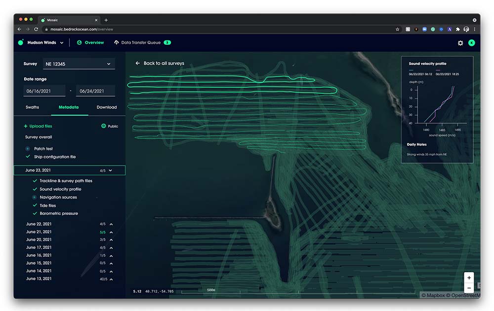
Bedrock Mosaic software compiles the data collect by the Bedrock AUV. | Image credit: Bedrock
A fully electric submersible
The company’s fully electric AUVs allows Bedrock to improve the speed and efficiency of seafloor acquisition and mapping, in some circumstances delivering data up to 50 times higher resolution than the best publicly available maps, the company claims. It geophysically maps the ocean floor in high resolution without the need for large survey ships accelerating the rate and increasing the efficiency of seafloor data acquisition.
Bedrock AUV Survey Advantages:
- Major reduction of human risk by leveraging AUVs — no danger of navigation at sea
- 100% electric – environmentally superior to ship or surface systems
- Minimal risk of animal and environmental damage due to size, conops, and sonars that stay above the 200kHz marine mammal limits – reduction of geophysical survey permitting required
- New operational flexibility – faster to mobilize and robotics are transportable by air. Minimized impact of weather on schedule by staying below the surface and steering clear of adverse weather on the surface
- Resolution and data quality as a selectable variable of a survey
- Mosaic™ included – All data delivered, accessed, and managed in the cloud, eliminating the need to ship hard drives
Mosaic’s beta waitlist — open to the public starting today — provides all owners, users, and managers access to seafloor data enabling them to efficiently share marine survey data. It is agnostic to the data acquirer, meaning anyone that touches seafloor data from raw to processed can have a centralized place to store and work with their data.
“In order to understand the state of the ocean, we need a baseline set of measurable metrics. Bedrock collects the needed data to drive proactive actions in areas of strategic impact for progress and prevention, rather than just being reactive” said Charlie Chiau, CTO and co-founder of Bedrock. “Our platform’s first and immediate application is to accelerate offshore renewable energy projects, which now need this ability for faster and repeatable discovery and monitoring of seafloor health and status.”
Within its current services, Bedrock is launching a free tier of 50GB of private seafloor data storage, which enables anyone with an internet connection a way to publish survey data to the free, public ocean dataset, as well as easily download anything already within it. Bedrock’s goal with this is to encourage the public to contribute any obtained marine data to the public map, in the simplest way possible.
With Bedrock’s AUV-based survey approach coupled with Mosaic, ocean-floor surveys — which are required for a myriad of critical infrastructure projects including the development, installation, and maintenance of every new offshore wind turbine — can be done faster, more efficiently, and significantly more environmentally friendly than ever before.
Takeaways
Bedrock is innovating with its high-performance, autonomous submersible. The submersible is untethered, and capable of autonomous mission operations during which the vessel can operate on a predefined mapping path while acquiring seabed data from a variety of onboard sensors.
The company is offering the output data and survey maps as a service, enabling clients to leverage this robotics-as-a-service solution without a huge capital investment.
The survey data that can be delivered includes:
- Conductive, temperature and depth
- Multi-beam echo sonar
- Sidescan sonar
- Magnettometer
- Sub bottom profiles


Tell Us What You Think!